
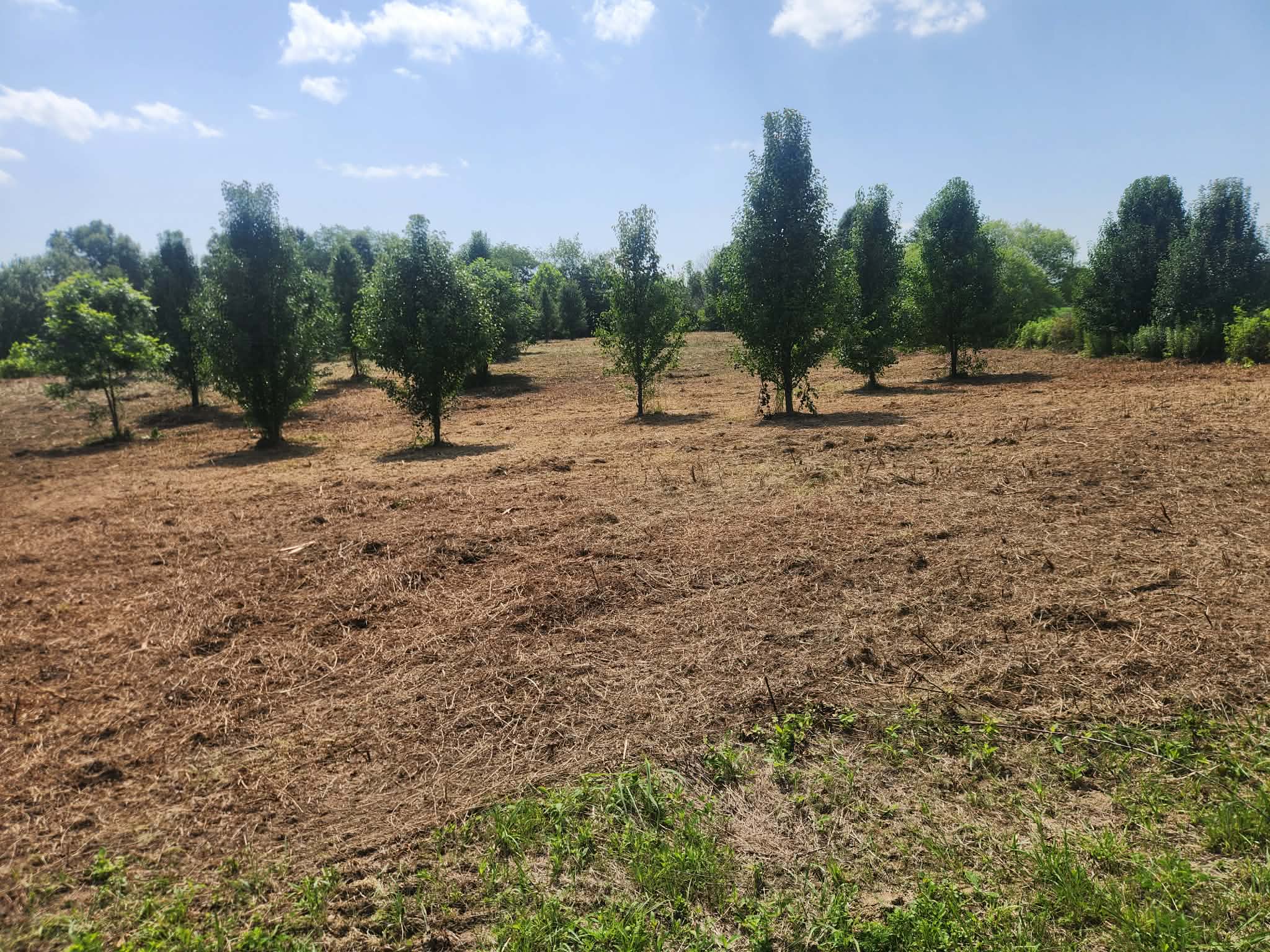
Rock Close to the Surface
Ridge tops here have sandstone within inches of the surface in places. We run the head high enough to keep off it, which is worth knowing because it changes how low a finish we can promise on a given ridge.
Service Area · Ironton, OH
Lawrence County is ridge and hollow, top to bottom. The usable ground is on the ridge or in the bottom, and everything between them is the slope that makes clearing here its own problem.
Property around Ironton tends to come in one of two shapes: a narrow ridge top with long steep sides falling away from it, or a hollow bottom with the hill closing in from both directions. Either way the flat is limited, the slope is not, and any equipment that has to work here needs to spread its weight.
That is where mulching earns its keep in Lawrence County. A tracked carrier grinds standing growth without pulling roots, so a side slope that has been holding together since the furnace era keeps holding together. Nothing gets pushed into a pile at the bottom of the hollow, and nothing has to come back out a road that was barely wide enough going in.
If your project is really a road cut, a pad, or stump removal, that is land clearing. If it is a grown-over route rather than an area, look at trail cutting.
The Land Around Ironton
Most of Lawrence County was cut over hard during the Hanging Rock iron furnace years and grew back on its own. What that left is even-aged second growth over thin soil, with sandstone close to the surface on the ridges and rock ledges showing through partway down the slopes. It is good ground to mulch and bad ground to dig.
North of town along SR 93 toward Pedro and Lake Vesuvius, and east toward Kitts Hill and Aid on SR 141, a lot of private tracts back directly onto the Wayne National Forest. Those parcels grow shut from the edges in, and the old ridge roads that once served them are usually the first thing to disappear under greenbrier and grapevine.
Ridge tops here have sandstone within inches of the surface in places. We run the head high enough to keep off it, which is worth knowing because it changes how low a finish we can promise on a given ridge.
Lawrence County slopes drop fast rather than run long. We cut across the face rather than straight up it, which is slower per acre but keeps the machine and the hillside where they belong.
Greenbrier and wild grape fill every gap in an even-aged canopy. That tangle is what makes a tract feel impassable long before the trees themselves are a problem.
Common Around Here
The road up the hollow was passable ten years ago and now it is a wall of vine. Mulching a corridor back open usually costs less than people expect, because it is a narrow strip rather than an area.
Tracts bordering the Wayne National Forest need the boundary respected exactly. Show us the line with flagging, pins, or an old fence, and we work to it and stop.
The flattest ground you own is often the most overgrown, because it grows the fastest and floods the worst. Mulching opens it without pushing debris into the creek.
Hunting camps get used two months a year and grow over the other ten. Access first, then the ground around the camp, usually one trip for both.
Straight Answers
Slope is the biggest driver here. Working across a steep face takes real time compared to open ridge top, and stem size does the rest. A stand of two-inch saplings is a different day than one full of six-inch hardwood. Send photos and a rough acreage and you will have a number back, usually inside 24 hours, at no cost.
It can, which is why we ask. Ridge sandstone, buried slag, and old wire from a long-gone fence are the three things that hurt a head around here. Point out anything you know about before we start and we work above it. Nobody wants a surprise stop halfway through your job.
That is one of the most common jobs we do in this county, and it is usually cheaper than clearing an equivalent area because you are paying for a strip rather than a field. Tell us how wide you want it. A UTV route and a truck-and-trailer route are different cuts.
We stop at whatever you can show us on the ground. If the federal boundary is marked with paint or witness posts, that is plenty. If nobody has walked that line in twenty years, get it flagged first. We would rather delay a job than cut across a line we guessed at.
Yes, along with Chesapeake and the rest of the Lawrence County river corridor. Ashland and Greenup County across the river are the same trip for us.
Free Estimate
Three fields to start. If it is a road or a corridor rather than an area, say so. That is priced differently and usually in your favor.
Same Trip For Us
Lawrence County and the river communities on both sides are one run for us. Not on the list? Ask. We regularly work past it.
Working somewhere else in the region? Start with forestry mulching across Southern Ohio and Eastern Kentucky, or go back to the BlueGrid home page for the full service area.
Step 1 of 5
We'll reach out within 24 hours, usually a lot sooner. While you wait, see what your property could look like.